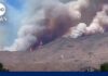
In the Grand Canyon, flash flooding is as much a logistical crisis as a meteorological one: when water moves fast in a narrow canyon, rescue timelines compress, communications vanish, and the difference between a successful evacuation and a fatality is measured in minutes and altitude.
The Short Version
- Park officials executed a rapid, coordinated evacuation after flash flooding in Bright Angel Canyon near Phantom Ranch; at least 62 people were airlifted to safety.
- Authorities reported a focused search for roughly 15–20 unaccounted-for individuals in specific backcountry zones, including the North Kaibab Trail and “the Box.”
- Early counts fluctuate in remote incidents; rescue and accountability proceed in phases—evacuation, search, reconciliation, and, if necessary, recovery.
- Recent and historical Grand Canyon events show a consistent incident-response sequence by the National Park Service and partner agencies.
What Happened: A fast-onset flood in a narrow canyon, and a textbook multi-agency response
Flash flooding struck Bright Angel Canyon and the Phantom Ranch area—one of the most trafficked inner-canyon hubs—prompting Grand Canyon National Park to coordinate evacuations with the Arizona Department of Public Safety. Officials airlifted at least 62 people from trails and inner-canyon sites as crews moved simultaneously to account for others who might have been in the affected corridor. Public updates focused search attention on the North Kaibab Trail, Bright Angel Campground, and the slot-like narrows known locally as “the Box,” north of Phantom Ranch.
The operation’s cadence will be familiar to anyone who has followed canyon rescues. Park staff stabilize immediate hazards, move people out of the floodplain, and then pivot to accountability—confirming who is safe, who self-evacuated, and who remains unaccounted for. In this incident, initial reports referenced “more than 20” people missing, with later public estimates converging around “about 15,” a typical narrowing as duplicate tips are reconciled and hikers check in from high ground or ranger stations.
Why counts change: the mechanics of accountability in places without signal bars
Remote terrain dictates the information tempo. Trail users spread out across miles of canyon with zero cellular coverage; bridges, low-water crossings, and creekside segments can be cut or destroyed, delaying both movement and messaging. In that context, the first numbers are provisional by design. Search managers triage: life safety first, then manifests and rosters. Helicopter evacuations create reliable headcounts of those flown out, but reconciling who remained by choice at high, dry camps, who hiked out on foot, and who never entered the affected zone takes longer. That is why you see an early “over 20” evolve to “about 15” as duplicate reports and safe check-ins are removed from the missing list.
Witness accounts underscored the violence of the flow. One evacuee described a bridge they had crossed being “wiped out,” a stark reminder that in slot-influenced reaches like the Box, flood energy is constrained laterally and expressed vertically and downstream—fast, debris-laden, and structurally destructive. In such corridors, moving to higher, durable ground is the only reliable immediate defense; infrastructure cannot be assumed to hold when boulders and logs are entrained in the surge.
How the Grand Canyon handles flash floods: phases, partners, and precedent
The National Park Service (NPS) runs canyon incidents through a repeatable sequence anchored in the Incident Command System: rapid size-up; evacuation and sheltering; search and accountability; and, if indicated, recovery and investigation. This pattern is well documented in prior Grand Canyon events. In August 2024, after a flash flood struck Havasu Creek, NPS publicly announced ongoing search-and-rescue operations, identified a missing hiker, then, two days later, issued a recovery notice with the decedent’s identity and the agencies leading the inquiry. The specificity of those communications—time, location, investigative authority—is not performative; it reflects legal and operational obligations that govern every major canyon incident.
The air component is equally structured. Depending on conditions, the park, the Arizona Department of Public Safety, and, when activated, the Arizona National Guard coordinate lift assets, flight following, and patient movement. Helicopter manifests, hoist logs, and landing-zone operations create the backbone of post-incident accounting. When operations run across multiple days or platforms—short-haul hoists from narrows, sling loads for gear, and separate patient transports—those records become the reconciliation tool for public-facing numbers like “evacuated by air” and “accounted for”.
Flash flooding in Grand Canyon leaves more than 20 people missing
【Al Jazeera – Breaking News, World News and Video from Al Jazeera】
— 株式会社トーラス・ライフ (@torus_life) August 31, 2026
The landscape’s physics: why timing and topography dominate outcome
Flash floods in the Grand Canyon are summer monsoon phenomena: high-intensity, short-duration storms dump rain into steep tributaries, producing rapid stage rises in creeks that normally run clear and low. In side canyons with slot characteristics, a modest basin can generate a disproportionate wall of water because there is little room for lateral spread. Debris—logs, root wads, cobbles—armors the flow, transforming it into a battering ram that undercuts banks and strips footbridges. Hazards are compound: even after the hydrograph’s peak passes, damaged crossings and unstable banks complicate foot egress, which is why aviation resources often remain the safest exit for clustered hikers at camp nodes like Phantom Ranch.
For visitors, the rule set is simple but non-negotiable. Heed Flash Flood Warnings; avoid narrow canyons when convective storms are forecast; never camp in dry washes; and, at the first sign of rising, muddy water, move immediately to higher ground. The canyon rewards early, decisive elevation gain far more than late heroics. For trip leaders, redundancy in communication—satellite messengers, ranger check-ins, and itinerary sharing—accelerates the accountability phase if conditions deteriorate.
A clear through-line: what the evidence supports
Across outlets, the backbone facts align. Park officials publicly described a coordinated evacuation and search, pegged the impact zone to Bright Angel Canyon and Phantom Ranch, and reported at least 62 air evacuations; rescue attention focused on a discrete set of trails and camps, and the missing count tightened from “more than 20” to “about 15” as reconciliation progressed. Eyewitness descriptions of destroyed infrastructure are consistent with debris-charged flood behavior in confined reaches. And the agency’s prior-year sequence at Havasu Creek—SAR announcement, identification of a missing person, then recovery notice and joint investigation—shows the same disciplined arc of incident management likely to follow here if outcomes require it.
One caveat belongs in any responsible account of early hours: missing-person tallies in remote terrain are inherently fluid until rosters, manifests, and self-reports align. That fluidity is a feature of careful accounting, not evidence of disorder. The decisive facts are the ones that save lives—in this case, rapid evacuations, targeted searches along known choke points, and a communications posture that narrows uncertainty as fast as the terrain allows.
Practical implications for travelers and operators
Plan for the canyon you actually face, not the one in your guidebook photos. Elevation, forecast, and route choice govern flood exposure more than fitness does. North Kaibab’s proximity to Bright Angel Creek makes it exquisitely scenic and, in storm cycles, particularly vulnerable at bridges and narrows; itinerary buffers, alternative egress options, and independent weather intelligence are not luxuries. Commercial and private leaders should pre-brief flood scenarios, designate high-ground rally points, and ensure at least one satellite-capable device per party. These habits do not eliminate risk, but they transform chaos into a solvable logistics problem when water rises.
Sources:
youtube.com, cbsnews.com, france24.com, nps.gov, abcnews.go.com
© fixthisnation.com 2026. All rights reserved.